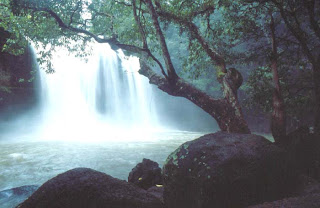
Khao Yai is Thailand's oldest National Park. It was designated on the 18th September 1962. At 2,168 km it is the largest National Park in Thailand. Located within the Dongrek Mountain Rang, Khao Yai's elevation ranges from 200 to 1351 m a.s.l. (Khao Rom)
History of Khao Yai, in 1902, 30 families from the south if Khao Yai moved into the Khao Yai hills. They farmed rice, hunted wildlife and collected forest products. The present grasslands along the road near the Head Quarters (HO) area are evidence of these villages and farms. In 1932 when Thailand became a Constitutional Monarchy, the government closed Khao Yai because the area had become a hideout for political criminals.In 1959 His Excellency Field Marshall Sarit Thanarat, then Prime Minister, asked the Agriculture and Cooperatives Department and the Department of Interior to look into the setting up of a National Park's System. In 1962 Khao Yai became the 1st National Park under the National Park Act of 1961. It is managed by the Royal Forest Department.

Topography
Khao Yai National Park consists of complicated mountains such as Khao Rom, the highest about 1,351 meters, Khao Lam about 1,326 meters, Khao Keaw about 1,292 meters, Khao Sam Yod about 1,142 meters, Khao Far Pha about 1,078 meters, Khao Kampang about 875 meters, Khao Samor Poon about 805 meters and Khao Kaew about 802 meters above sea level. Moreover, the area has vastly grassy field alternating with productive forest. The north and the east part are smoothly sloping down, while the south and the west part are rising up. The area is the source of five main rivers as follows.
(1) Prachin Buri River and
(2) Nakhon Nayok River situated in the south part and important for local agriculture and economy, meet each other in Chachoengsao District to become Bangpakong River go to the Gulf of Thailand.
(3) Lam Ta Kong River and
(4) Praplerng River, in the north part, go to maintain the agriculture of Korat Plateau and meet Moon River, the main river of Southern Isan that goes to Khong River.
(5) Muag Lek Stream, located in the northwest part and going to Pasak River in Muag Lek District, is valuable for local agriculture and cattle, and has water all the year round.

Climate
It is often cooler up here with an average temperature of 23 C.
Rainy Seson: May - October. Rains most days, the waterfalls are thus stunning. Can get clear cool weather.
Cold Seson: November - February. Gets as cold as 10 C at night you will want blankets. Again clear weather with great sunsets is common.
Hot Season: March - April. Hot and dry, but still cool compared to the plains, reaching the mid 30's!
No comments:
Post a Comment